by Albert Kollar
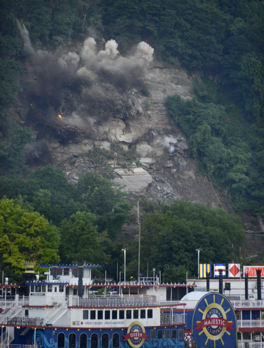
The recent blasting (not the 4th fireworks) of rocks onto the railroad tracks along West Carson Street is one of the great geology stories of Pittsburgh. The large boulder pictured in the July 6, Pittsburgh Post-Gazette story is sedimentary rock formed more than 300 million
years ago when Pittsburgh was situated near the equator during a time of warm, dry, and wet climate.
The landscape was a broad coastal area similar to today’s southern United States at New Orleans. The rivers back then flowed northwest draining out from the rising Appalachian Mountains forming off the east coast of ancestral North America. The salt water sea or coast line at the time was situated west near Columbus, Ohio.
After the Appalachians formed erosion of the massive mountain of rocks eroded down over millions of years to approximately what we see today as the flat top of Mt. Washington or Grandview Avenue.
Then the Ice Age came and helped form the River Valleys of the Allegheny River and the Monongahela River, forming the new Ohio River at the Pittsburgh point. We know from geology that the steep slope sides along the river valleys are unstable and have been for thousands of years.
Once Pittsburgh was established in 1758 with the fall of French Fort Duquesne, civilization, industrialization, and building of the railroads in 1850 and 1900 into the hillside above W. Carson Street, created more destabilization of the hillside. Now more rocks fall.
Albert D Kollar is a geologist at Carnegie Museum of Natural History. Museum employees are encouraged to blog about their unique experiences and knowledge gained from working at the museum.
