By Erin Peters
I arrived at Sheikh Abada for Egypt’s Ministry of State for Antiquities (MSA) and the Istituto Papirologico “G. Vitelli” of the University of Florence’s (Istituto) Italian Mission at Antinoupolis under direction of Rosario Pintaudi, PhD. I am thrilled to join the team here at this famous ancient city, which has been important since pharaonic times (there is a temple built by Ramses II that I will return to in a future post) and especially after its founding under the Roman emperor Hadrian as a Greek poleis in Egypt (administrative center of a nome, or district) for his companion, Antinous. Antinous is said to have drowned in the Nile River in 130 BCE. According to Egyptian tradition, he was affiliated with the god Osiris and thus deified after his death; Hadrian founded the city as the cult center of the new god—Osir-Antinous. The Istituto’s mission, along with The Antinoupolis Foundation (TAF) under President James Heidel, is to build a complete archaeological picture of the city, cult center, and its inhabitants.
You can read all the latest news, history of the city, and its archaeological campaigns at The Antinoupolis Foundation’s website and blog.
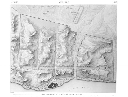
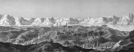
In my last blog post, I mentioned the vast archaeological site that is home to the ancient city’s remains on the Nile River. The site, along with its street grid, was documented by Edmé Francois Jomard, one of the scholars who accompanied Napoleon’s army to Egypt in 1798–1801, and published in the massive Description de l’Egypte. The engraving shows the city plan with a large hippodrome to the east of the Nile, a “wadi” that runs from the east to the Nile, and three major streets: the “cardo” that runs north-south and is parallel to the Nile and two “decumani” that run east-west and are perpendicular to the Nile. In ancient Roman cities, the “cardo” refers to the primary north-south street, and a “decumanus” is a primary street that runs east-west.
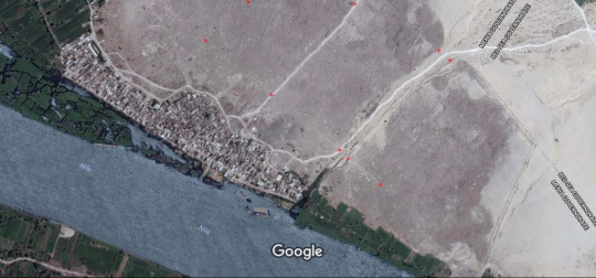
Because the official founding of the city occurred under the Roman emperor Hadrian, the Roman period city included urban elements similar to the rest of the empire. These features are still visible today and can be seen from Google satellite images. I have included small red dots near the “wadi,” the “cardo,” and the “decumani.”
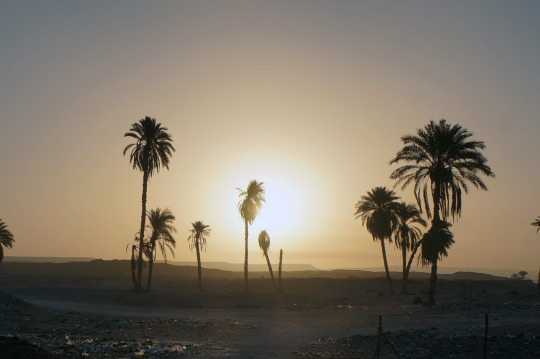
Now on site, I cannot wait to see the town plan in person and begin the first full day at Antinoupolis with the rising sun at dawn.
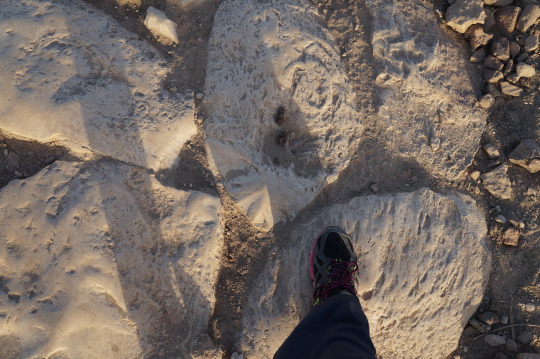
For me to get a sense of the site, TAF’s President Jay Heidel (who invited me to join the mission) and the mission’s Director Rosario Pintaudi kindly showed one of the main attractions in person: the “cardo” complete with some of the granite column shafts in situ. The “cardo” was paved with large limestone blocks that gleam in the Egyptian sun, and it is possible to see the stones along the “cardo” far across the site.
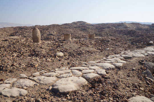
When Jomard visited the site at the turn of the 19th century, there were many more columns and shafts along the main streets—he even recorded some large pilasters and complete columns with Corinthian capitals.
But today it is quite rare to see shafts of any size still in situ, and it is more common to see them fallen at the side of the limestone pavement, if at all.
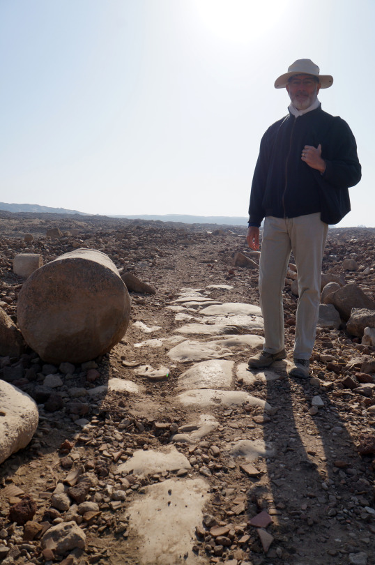
It was an amazing experience to walk along the street that Hadrian built for Antinous and sets the tone for my stay at Antinoupolis.
Erin Peters is an assistant curator of science and research at Carnegie Museum of Natural History and is currently in Egypt for an archaeological research study. This is a series of blog posts she has written while in the field. Check back for more!