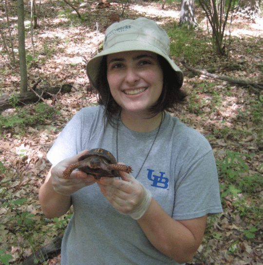
Hello everyone, my name is Amanda Martin and I’m a new post-doctoral researcher in the Amphibians and Reptiles section. I received both my Ph.D. and M.S. in Biological Sciences from Bowling Green State University, and my B.S. in Psychology and Interdisciplinary Studies from the State University of New York at Buffalo.
My herpetological career all started after watching Anaconda, the movie, when I was about six years old. I did not like the depiction of this wonderful creature, and since then I have been passionate about conserving and reducing other’s fear of snakes. During graduate school, I discovered that I really enjoy other amphibians and reptiles, especially the abundant red-backed salamanders which I found under logs almost every day during my research surveys. Even though I love studying snakes, I spent most of my time working with eastern box turtles using radio telemetry. One of my favorite aspects of working with these turtles is that they are easy to catch! I did, however, have some ninja turtles that liked to hide from my volunteer research assistants. Finding amphibians and reptiles can be quite challenging. I love this kind of treasure hunt because it is incredibly rewarding when you do find them!
Check out my website for more information about my previous research at: https://amandkm.wixsite.com/martin
Conservation in Action: Exploration of Changes in Land Cover over Time
In northwestern Ohio and southeastern Michigan lies a dynamic and diverse landscape, the Oak Openings Region which has been the focus of large ongoing conservation by the Green Ribbon Initiative. Over ten years ago, a land cover map was created to facilitate the enhancement and restoration of critical natural areas. Since then, local conservation partners have been changing the landscape to increase the area of natural habitats, such as upland prairie and savanna. But to see whether these efforts worked or not, they needed a new map to see these changes on the landscape. We, Martin and Root 2020, worked together with our local partners to build an updated map for region and explored these changes in land cover over a 10-year period.
We used satellite imagery and trained our model with confirmed ground sites for 14 different land cover types, including five communities of concern (swamp forest, floodplain forest, deciduous forest, upland savanna/prairie, and wet prairie). We then examined change over time by comparing total area or number of patches per land cover between the 2016 map and the 2006 map. We found that natural land covered 33% and human-modified land covered 67% of the total region. Over 10 years, natural classes increased, and cultural classes decreased in total area by 5.8%, although not all types of natural habitat increased (e.g., forest habitat decreased) and much of the natural habitat was found in small isolated pieces rather than large blocks of similar habitat. Many of these changes are likely a result of natural recovery and disturbance, and conservation efforts by the Green Ribbon Initiative. This large-scale view for conservation is needed to create conservation initiatives for different species and their natural habitats and illustrates the challenges that land managers face in restoring natural lands as humans continue to modify their surroundings.
Scientists use these types of land cover maps to better understand the interaction between species and their habitats. One aspect of this interaction is the creation of habitat suitability models, where you identify potential new habitat locations for species using occurrence data (where you find an individual) and environmental layers (land cover, elevation, distance to streams or roads, etc.). We did this for 15 target species focused on the 5 major communities of concern for Oak Openings Region using this land cover map. As Dr. Martin starts her new work with Dr. Sheridan in the amphibian and reptile section, they will be exploring this type of research utilizing the museum’s vast collection!
Link to article: https://doi.org/10.1007/s00267-020-01316-2
Journal: Environmental Management
Title: Examining Land Use Changes to Evaluate the Effects of Land Management in a Complex, Dynamic Landscape
Abstract: Anthropogenic alterations to landscapes have increased as the human population continues to rise, leading to detrimental changes in natural habitats. Ecological restoration assists in recovery by altering habitats to improve conditions and foster biodiversity. We examined land cover changes over time within a complex, dynamic region in the Midwest to assess the long-term effects of conservation. We used Landsat 8 bands for a 15-class land cover map of Oak Openings Region using supervised classification. We validated our map and achieved an overall accuracy of 71.2% from correctly classified points out of total visited points. Change over 10 years, from 2006 to 2016, was explored by comparing class statistics from FRAGSTATS between our map and original land cover map. We found that natural land, i.e., forest and early successional, covered 33%, with 10% permanently protected, while human-modified land, i.e., agricultural and developed, covered 67% of the region. Over 10 years, natural classes increased, and cultural classes decreased by 5.8%. There were decreases for the three forest communities and increases for the two early successional communities. These changes are likely the result of natural recovery and disturbance, and conservation efforts by the Green Ribbon Initiative. Changes in habitat also came with distribution changes, e.g., increased fragmentation for some classes, which was readily visible. Our useful method measured functionality by emphasizing changes in composition and configuration. Our approach provides a tool for assessing cumulative regional-scale effects from site-level management and conservation. This large-scale view for conservation is needed to effectively mitigate future changes.