by Albert D. Kollar and Wendy T. Noe
In the early morning of January 28, 2022, Pittsburgh’s 52-year-old Fern Hollow Bridge collapsed into Fern Hollow Run of Frick Park. Thankfully, there were no fatalities. The event made local and national news1. On February 7, the National Transportation Board (NTSB) reported it could take 12 to 18 months for a final report to determine the cause of the collapse2.
Fern Hollow Bridge
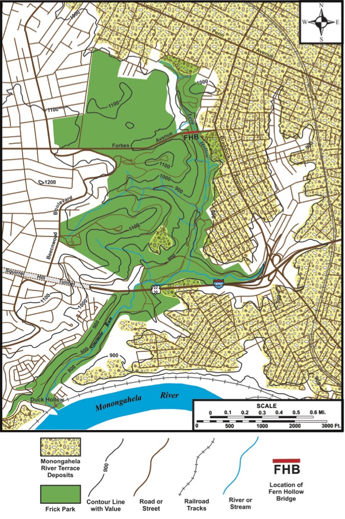
The now infamous bridge, which carried Forbes Avenue’s vehicle and pedestrian traffic between Squirrel Hill and Regent Square, crossed a Frick Park hollow at the 900-foot contour level from anchor points at the base of the sedimentary rock unit known as the Morgantown Sandstone (fig. 1, fig. 4b). The bridge, one of 446 bridges in the City of Pittsburgh,1 was a steel rigid frame, a design in which the superstructure and substructure are rigidly connected to act as a continuous unit. The structure included three spans, with a total length of 447 feet (48.7 meters). Its road surface was 160 feet above (48.7 meters) Fern Hollow Run, and the bridge operated with a weight limit of 26 tons2.
To Cross a Bridge
Bridges are built to carry people, all manner of the materials we require, and the vehicles used to transport both, across obstacles that would otherwise disrupt the smooth and timely flow of traffic. In our modern world bridges are frequently constructed to cross other built structures. Think pedestrian bridges over roadways, or highway bridges over busy rail lines. Mostly, however, bridges cross geologically formed features such as rivers and the myriad forms of depressions carved into the landscape over time by flowing water. Whether we call them valleys, ravines, or hollows, our region’s familiar landscape features are evidence of the impact of erosion on what was once far more level terrain.
Pittsburgh, with 446 bridges within the city limits, has long been known as the City of Bridges. The title is appropriate because the tally far exceeds the number of bridges in Venice that cross the Italian city’s network of canals3. Bridges are so common in Pittsburgh that for many residents it’s a daily experience to both cross over and pass under a bridge.
In human history, one of the oldest existing bridges dating from antiquity is the single-arch stone bridge over the Meles River, built c. 850 BC in Izmir (formerly Smyrna) Turkey.4
In Pittsburgh, the first fixed river crossing structure was the Monongahela Bridge, which was built in 1818. The form of this landmark can be inferred from Russell Smith’s Old Monongahela Bridge, a painting in the Carnegie Museum of Art (CMOA) collection that depicts the bridge during its construction. This largely wooden bridge burned during the great Pittsburgh fire of 1845, destruction captured in another CMOA landscape painting, View of the Great Fire of Pittsburgh, by William C. Wall. In 1883 the award-winning Smithfield Street Bridge rose from the ashes at the site of the former bridge. The Pittsburgh History and Landmarks Foundation designated the Romanesque Pauli lenticular truss as an historic bridge in 1970, recognition reinforced in 1977, when it was also cited as a City of Pittsburgh Historic Structure. It’s therefore reasonable to hope that a new Fern Hollow Bridge may one day be cited as having an award-winning design like the Smithfield Street Bridge.
Pittsburgh Geology
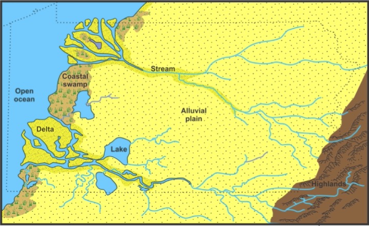
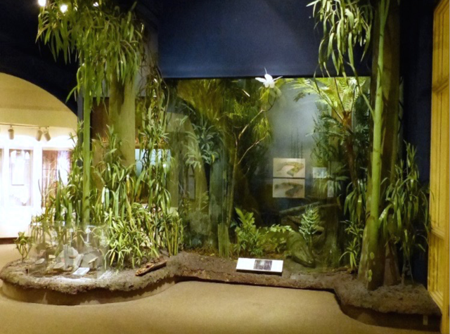
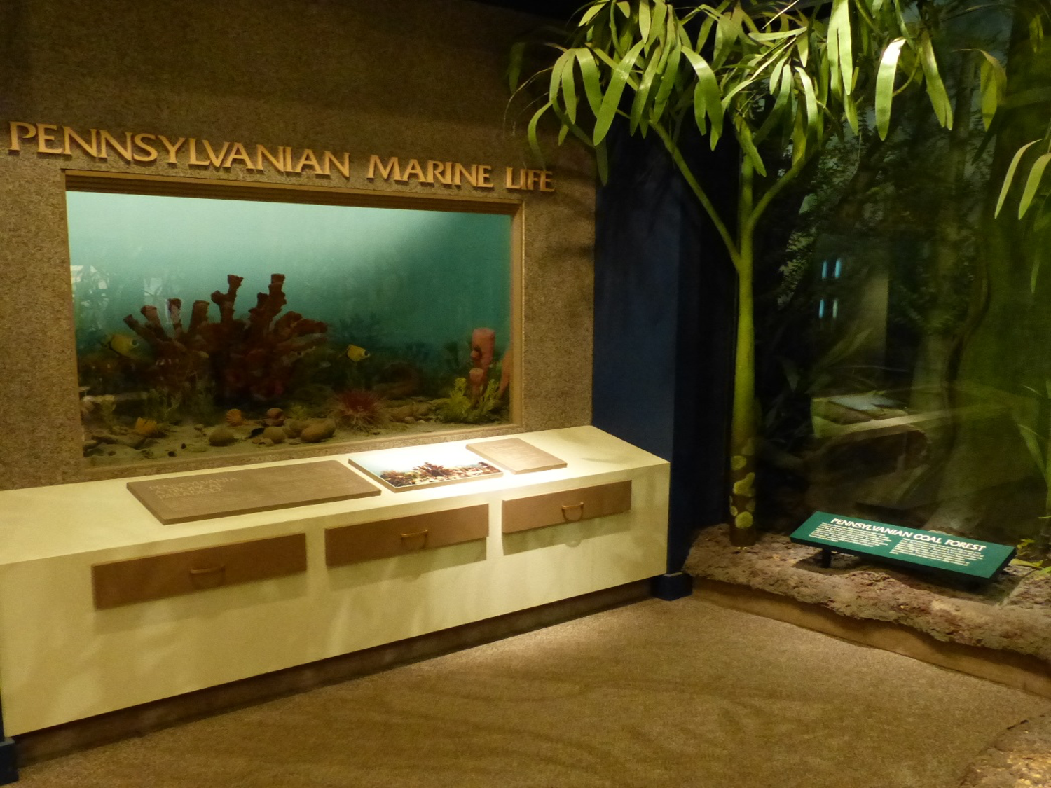
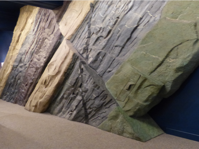
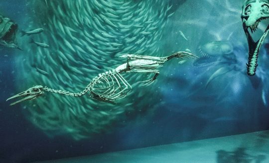
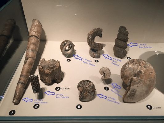
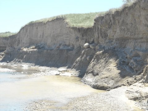
Understanding the origins of the landscape features in Pittsburgh that make hundreds of bridges a necessity requires background knowledge of two long and widely spaced periods of Earth’s geologic history. Conditions during the first period help explain why rock layers here appear (mainly in roadcuts) stacked in relatively flat layers. During the Pennsylvanian Period (319 million to 299 million years ago), what is now Pittsburgh was centered near the equator where the fluctuating levels of a tropical sea deposited lime mud that later hardened to limestone. In lush swamps that covered much of a broad sea edge coastal plain, tropical plants grew so dense that their remains were later transformed into coal deposits. Large rivers that flowed from the eroding ancestral Appalachian Highlands, hundreds of miles east of Pittsburgh, carried sand, silt, and mud to the coastal plain, forming sandstone, siltstone, and shale along the way5 (fig. 2).
The lithified sediments formed strata that became the bedrock beneath the Pittsburgh area. Geologic forces have been changing the landscape ever since. First through formation of the Appalachian Mountains by the action of plate tectonics, c. 260 million to 250 million years ago, followed by 250 million years of erosion. The majestic Appalachians were reduced to a broad plateau in western Pennsylvania where rivers and creeks meandered across a gently rolling plain creating wide shallow valleys.
Before the Ice Age
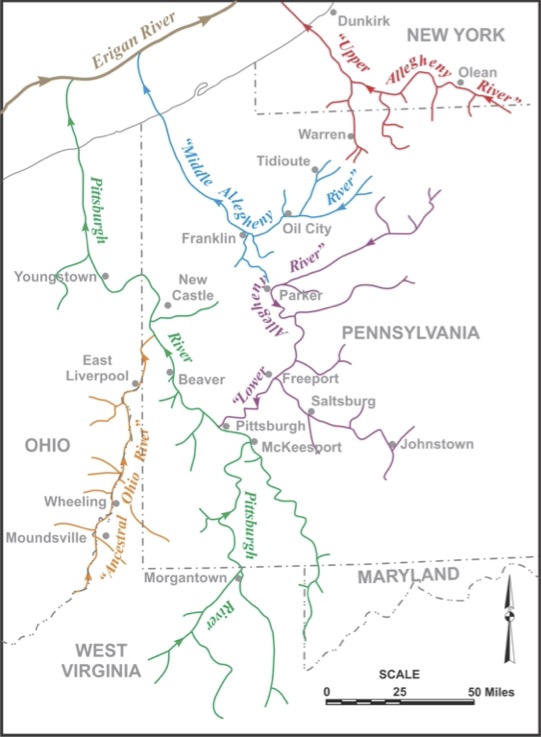
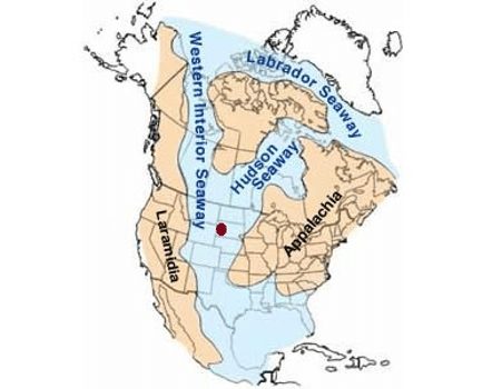
As global climate cooled after the warm Pliocene Epoch (5.3 to 2.6 million years ago), glaciers started to form in Arctic Canada. In Western Pennsylvania at the time the drainage patterns of the ancestral Three Rivers and their tributaries flowed north and northwest from southern West Virginia through the Pittsburgh area and eastern Ohio, eventually converging with the Erigan River in what is present day Lake Erie (fig. 3). The Erigan River, thought by geologists to have been ancestral to the St. Lawrence River, flowed to the Atlantic Ocean6.
In Pittsburgh, Monongahela River sediments were laid down as terrace deposits (clay, silt, cobbles, and boulders), creating a relatively flat bottomland, a base for the major traffic arteries of the city’s East End (fig. 1)9.
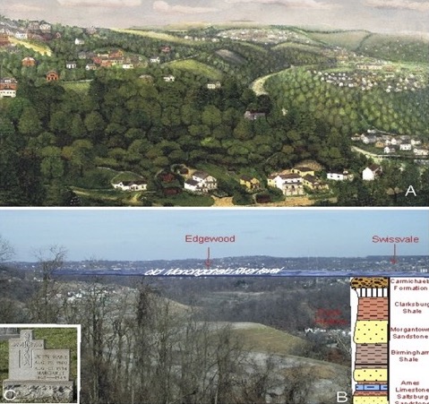
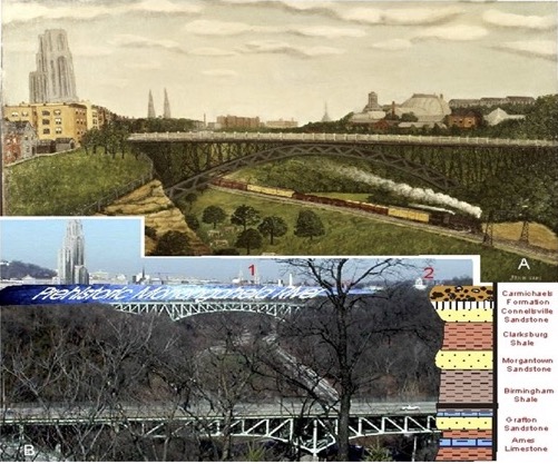
Kollar and Brezinski (2010) visualized the pre-Ice Age ancestral Monongahela River through a geologic lens using two paintings by John Kane, “Nine Mile Run Seen from Calvary,” c. 1928 (fig. 4a) and fig. 4b geology version and “Panther Hollow, Pittsburgh,” c. 1930 – 19349 (fig. 5a) and fig. 5b geology version.
Here Comes the Ice Age: The Pleistocene Epoch in Western Pennsylvania
It was during the Ice Age or Pleistocene Epoch (2.6 million to 11,700 years ago)7, when the erosional actions of water impacted Pittsburgh’s landscape.
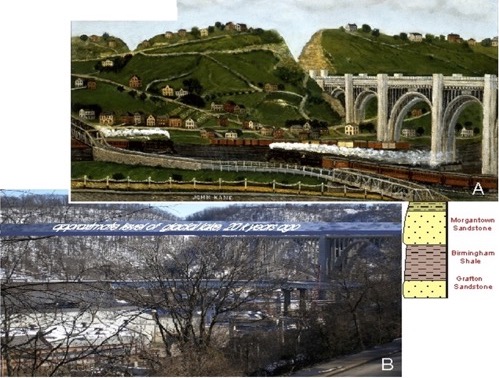
Thick glacial ice sheets advanced into western Pennsylvania at least three times, starting with the earliest known advance, 700,000 years ago. The last glacial incursion occurred some 20,000 years ago, when the Laurentian Ice Sheet advanced to the N400, about 40 miles northwest of Pittsburgh, depositing terminal moraine sediments in southern Butler and Lawrence counties8.
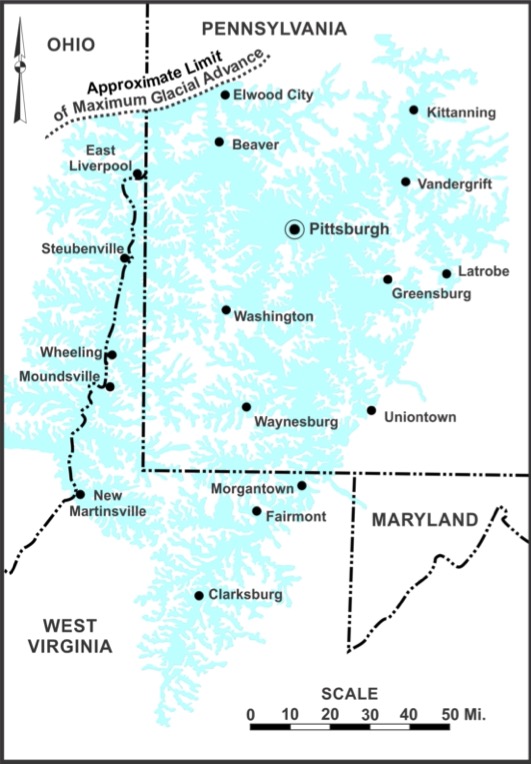
With each advance of the glaciers, ice dammed the northwest flowing rivers (fig. 3). Like a clogged bathtub, water levels rose, backing up into creeks, streams, and runs to an elevation of approximately 1,100 feet (335 meters)6 to form Lake Monongahela7. Fig. 6 indicates in blue the highest water level of Lake Monongahela, a level high enough to breach and subsequently erode channels over drainage divides.
This erosion through existing divides changed the region’s drainage from northwest towards the ancestral Great Lakes, to southwest towards the Gulf of Mexico, with the present-day Ohio River as the primary channel7.
An example of geology changing the course of history.
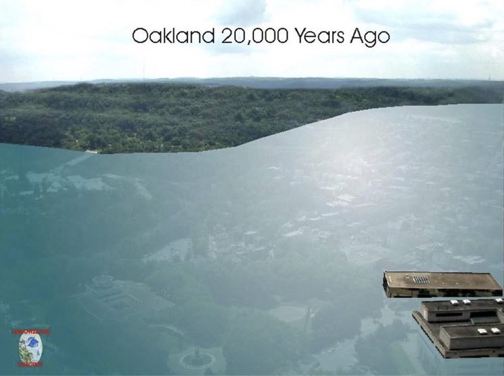
Lake Monongahela was geographically extensive. It extended east to Latrobe, south to Clarksburg, WV, west to eastern Ohio, and north to Elwood City (fig. 6). All of Oakland, including the current locations of Carnegie Museums and the University of Pittsburgh campus were flooded (fig. 7)5. Even the George Westinghouse Memorial Bridge (1932) in East Pittsburgh standing 240 feet (73.1 meters) above Turtle Creek would have been covered by Lake Monongahela (fig. 8b). See John Kane’s landscape painting, Turtle Creek Valley No. 1, c. 1930 (fig. 8a)10.
Geology of Fern Hollow
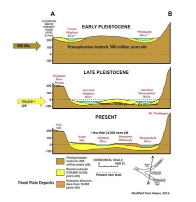
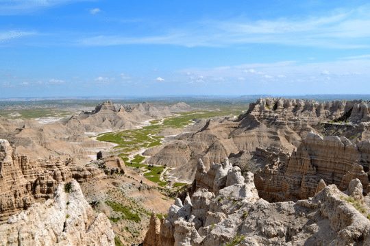
As the glaciers advanced into, and melted back from, northwestern Pennsylvania, the weight of the ice had impacts on the Earth’s crust in the northern latitudes of North America. The crust would compress with the advance of the ice, and then slowly rebound each time the ice sheets melted. As a result of these fluctuations and continued erosion, during the time period stretching from Early Pleistocene to the present, the landscape shifted from a gently rolling plain dissected by shallow, meandering stream valleys into broader, deeper valleys, deeper hollows, and ravines6 (fig. 9).
In Frick Park, the strata exposed along the eastern flank of the ravine at the Fern Hollow Bridge, as shown in (fig.1, fig. 4b,) consists of sedimentary rocks from the Carmichaels Formation9. The current floor of Fern Hollow is Saltsburg Sandstone, a unit formed about 300 million years ago9. Sedimentary rocks are, by nature, more prone to erode than igneous and metamorphic rocks, which don’t occur in western Pennsylvania. Some estimates propose that it takes about a million years to erode approximately 164 feet (50 meters) of rock11 within the river valleys and hollows of this region. Assuming this estimate is valid, which might not be the case, it would have taken a million years for the valley of Fern Hollow Run, and that of nearby Nine Mile Run, to be eroded to their present elevations.
Summary
Every bridge crossing is a potential encounter with geology. This scientific discipline offers insight into the natural dynamics that shape landscapes through deposition of sediments, mountain building, and erosion, all factors that help account for the locations where our region’s hundreds of bridges were built as transportation necessities.
Albert D. Kollar is Collections Manager for the Section of Invertebrate Paleontology at the museum Kollar and Wendy T. Noe serve on the Board of Directors of Pittsburgh Geological Society. Museum employees are encouraged to blog about their unique experiences and knowledge gained from working at the museum.
References
Brezinski, D. K. Fig. 7.
Harper, J. A. Figs. 1, 2, 3, 6, 9.
Kollar, A. D., and Brezinski, D. K. Figs. 4, 5, 8.
1New York Times, 28 January 2022.
2Guza, M. 2022. NTSB report: Pittsburgh’s Fern Hollow Bridge collapse started on Squirrel Hill side. Pittsburgh Tribune Review.
3Bramgati, A., et al. 2003. The Lagoon of Venice: Geological setting, evolution and land subsidence. Episodes, 26, 264-268.
4ASMOSIA XII INTERNATIONAL CONGRESS. 8 – 14 October,2018, Izmir, Turkey.
5Brezinski, D. K. and A.D. Kollar. 2005. The Geology of Schenley Park: A Record of Climate and Sea Level Change 300 Million Years in the Making. PAlS Publication Number 1, 5 p.
6Harper, J. A. 2016. The Geological Evolution of Pittsburgh’s Three Rivers. PAlS Publication 21, 5 p.
7Harper, J. A. 2002. Lake Monongahela: Anatomy of an immense Ice Age Pond. Pennsylvania Geology, 32, p. 2-12.
8Harper, J. A., and A. D. Kollar. Geology of a Former Pleistocene Bog in Bridgeville, Allegheny County, Pennsylvania. Pennsylvania Geology. In review.
9Brezinski, D.K. and A. D. Kollar. 2005. The Geology of Frick Park A 300 Million Years Record of Climate and Sea Level Change. PAlS Publication Number 3, 5 p.
10Kollar, A.D.,and 10D.K. Brezinski. 2010. Geology, Landscapes and John Kane’s Landscape Paintings. PAlS Publication 10, 5.
11 Kurak, E., et al. 2021. INCISION OF THE YOUGHIOGHENY RIVER THROUGH THE LAUREL HIGHLANDS DETERMINED BY A NEW RIVER TERRACE STRATIGRAPHIC AGE MODEL, OHIOPYLE STATE PARK, SOUTHWESTERN PENNSYLVANIA. Eds. Shaulis, J., Pazzaglia, F., and Lindberg, S. Guidebook for the 85th ANNUAL FIELD CONFERENCE OF PENNSYLVANIA GEOLOGISTS October 7 — 9, 2021.
Related Content
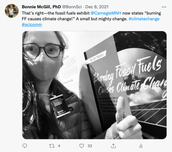
Understanding Fossil Fuels Through Carnegie Museums Exhibits
The Connemara Marble: A Cross-Atlantic Connection Between Ireland and Pittsburgh
Carnegie Museum of Natural History Blog Citation Information
Blog author: Kollar, Albert D; Noe, Wendy T.Publication date: February 23, 2022