• Skip to primary navigation
  • Skip to main content
  • Skip to primary sidebar

Carnegie Museum of Natural History

One of the Four Carnegie Museums of Pittsburgh

  • Visit
    • Buy Tickets
    • Visitor Information
    • Exhibitions
    • Events
    • Dining at the Museum
    • Celebrate at the Museum
    • Powdermill Nature Reserve
    • Event Venue Rental
  • Learn
    • Field Trips
    • Educator Information
    • Programs at the Museum
    • Bring the Museum to You
    • Guided Programs FAQ
    • Programs Online
    • Climate and Rural Systems Partnership
  • Research
    • Scientific Sections
    • Science Stories
    • Science Videos
    • Senior Science & Research Staff
    • Museum Library
    • Science Seminars
    • Scientific Publications
    • Specimen and Artifact Identification
  • About
    • Mission & Commitments
    • Directors Team
    • Museum History
  • Tickets
  • Give
  • Shop

Carnegie Museum of Natural History

May 4, 2022 by Erin Southerland

Exploring the Role of Leaf Litter In Our Forests

by Abby Yancy

Leaf litter is the dead plant material that has fallen from trees, shrubs, and other plants. It hangs around on the ground surface until it decomposes, with some plant species producing leaf litter that takes longer to decompose than others. You may have read about stopping the practice of raking your leaves in the fall because of the important nutrients and habitat for beloved wildlife the fallen material provides in your own backyard. The same goes for our forests, an environment where scientists have studied this critical component for many decades. 

early wildflower growth under leaf litter and snow
Early growth of spring beauty (Claytonia virginica), mayapple (Podophyllum peltatum), and bloodroot (Sanguinaria canadensis) under a layer of pawpaw leaf litter on March 10, 2022. 

The leaf litter in forests acts as a protective layer for soil conditions. It creates a physical barrier between the soil surface and atmosphere that reduces soil drying, responds to atmospheric temperature fluctuations, and reduces erosion from precipitation events. Through decomposition, nutrients stored in the dead material re-enter the system and act as a natural fertilizer for plants throughout the year. The controls and nutrient cycling are especially important for forest wildflowers. 

Many forest wildflowers begin their aboveground life cycles in early spring before the trees have developed their leaves. During this time, light at the forest floor is highest, allowing wildflowers to gain high amounts of energy. However, before they emerge from below ground storage organs or germinate from seeds, the flowers are thought to rely on environmental cues to know when to begin this growth without the risk of frost damage. These environmental cues include soil temperature, which is regulated by the leaf litter layer. Despite many decades of research on the leaf litter component of forests, little is known about the influence of it on the timing of these lifecycle events (or phenology) for wildflowers. Past and ongoing research in the CMNH Section of Botany explores the changing phenology of many plants. One ongoing project is looking at the impact of early tree leaf out and the extended phenology of non-native shrubs on forest wildflower phenology and biological success. 

leaf litter research plots
March 10, 2022. An example of a leaf litter manipulation plot. From left to right: litter addition, litter removal, and control. 

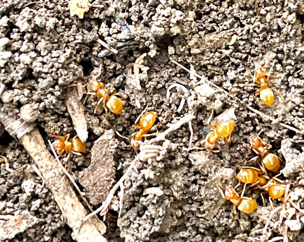
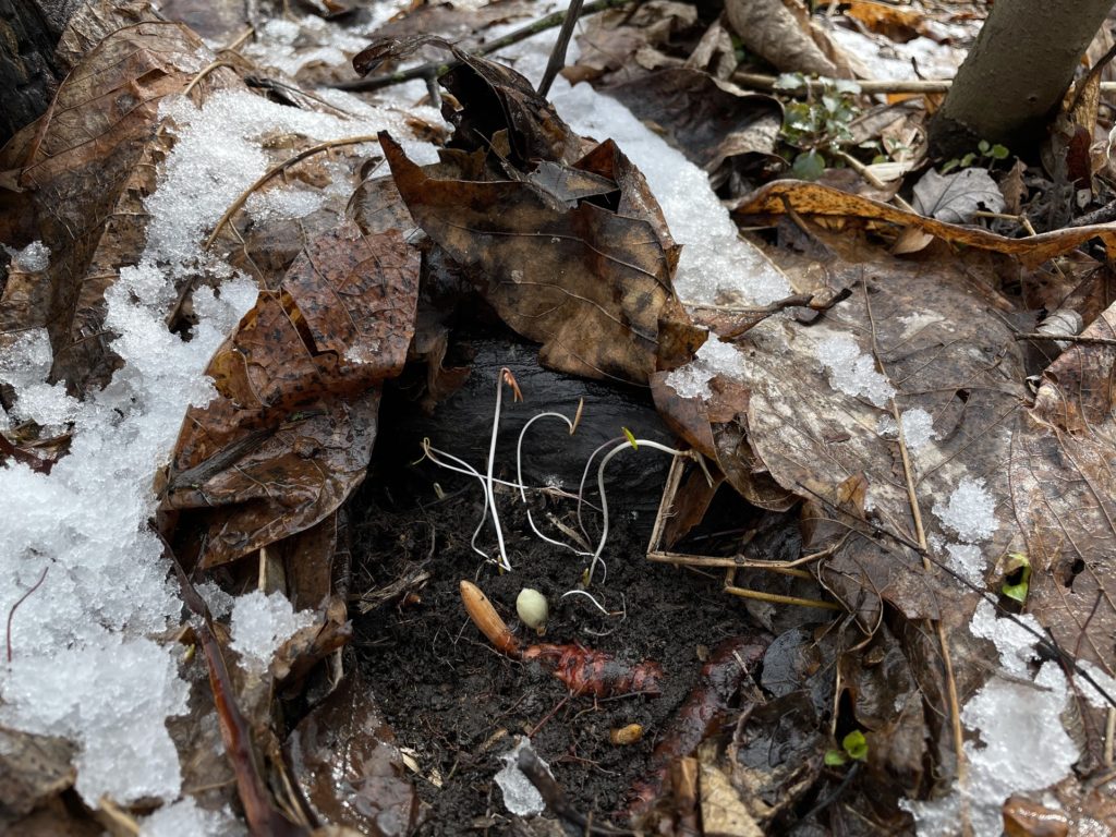
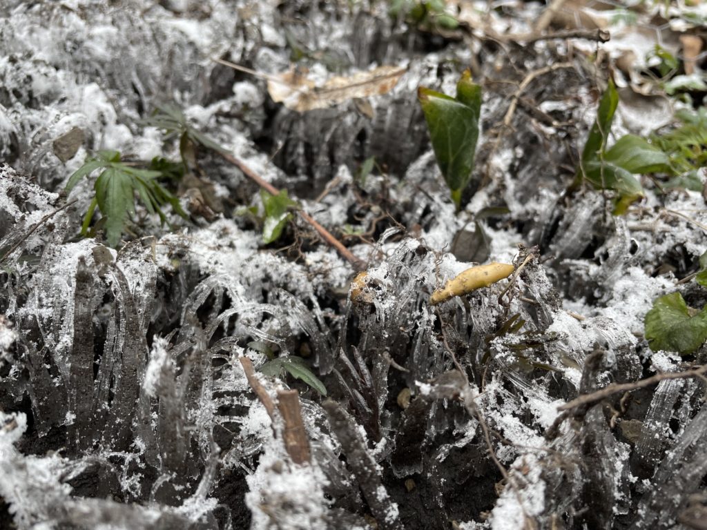
The question of the leaf litter’s role in wildflower phenology arose after some simple, but fascinating, natural history observations early last spring—noted variations in phenology within our research site. We struggled to find some tagged individual plants, despite many of the same species being not only present in surrounding areas, but in full bloom. After moving the layer of leaf litter, we found the “missing” plants nearly a week behind in growth compared to their neighbors. These observations were more common than initially thought, and strongly related to the decomposition rate of each leaf litter species. Tree species that produced slower-decaying leaf litter delayed the phenology of plants more than those that produced faster decomposing litter. This underexplored relationship inspired one of the research projects I’m working on this year. 

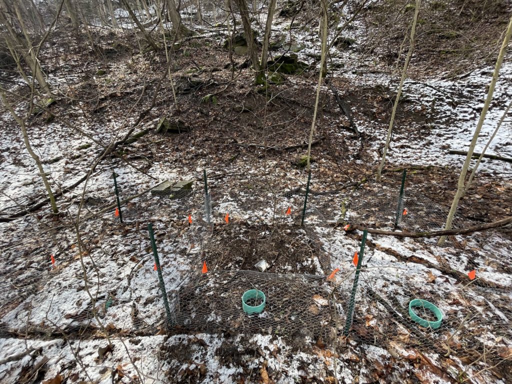
My project is aimed at understanding how different amounts of leaf litter control the cues for wildflower phenology. Specifically, I want to know how leaf litter regulates the soil temperature and moisture within relatively small areas of our site and how the wildflowers respond. To test this, I have several leaf litter manipulation plots where I removed all leaf litter in some subplots and added it to another of the same size. To measure the changes related to leaf litter, I record soil temperature and moisture and wildflower phenology. 

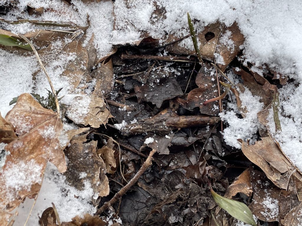
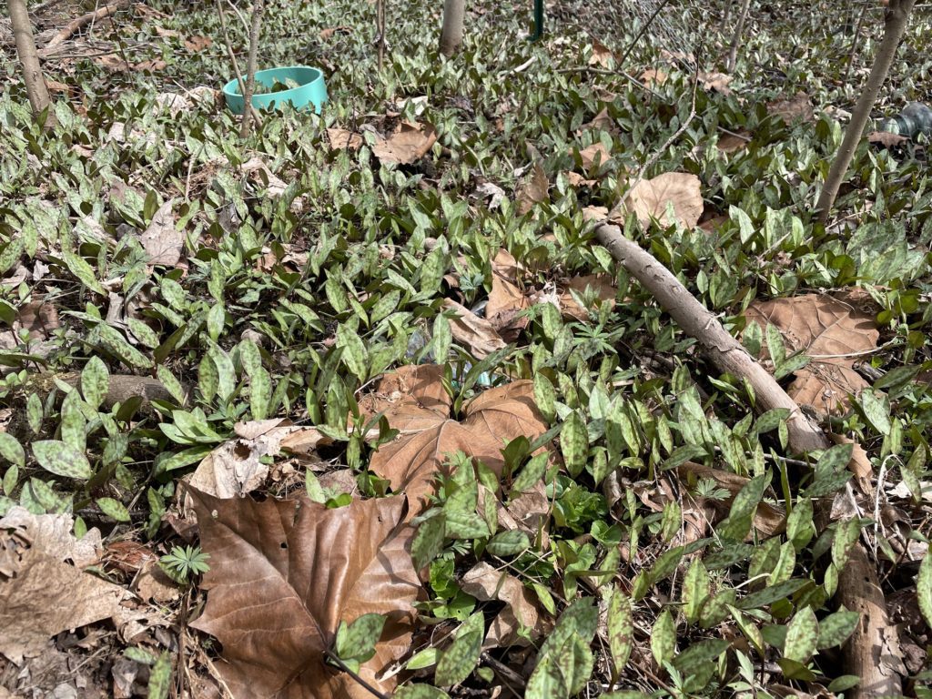
I began collecting this data in early March and have already noticed many differences. Before many of the flowers have started their aboveground lifecycles, they were already present in plots without leaf litter, but still hiding under the leaves in both the litter addition and the control plots. On a few of our random freezing days, the top layer of soil and plants were frozen in litter removal plots, while the same layer of soil was moist and visibly warmer in the litter addition plots. Additionally, one wildflower, trout lily, frequently grew around stray Sycamore leaves, which happen to be one of the slower decomposing species. 

March 28, 2022. Leaf litter removal. Top layer of soil is frozen, leaving early growth on wildflowers at risk of frost damage.
March 28, 2022 (same day and time as above picture). Leaf litter addition. After moving some leaf litter, the soil is not frozen, and wildflowers have extra protection from the freezing temperatures. 
April 1, 2022. Control plot. Trout lily growing around stray Sycamore leaves. 

The findings from this project will not only allow us to gain a better understanding of relationships among species but will also provide a basis for understanding variations in phenology within a site. 

Stay tuned for final results from this project!  

Abby Yancy is a researcher in the Section of Botany. Museum employees blog about their unique experiences and knowledge gained from working at the museum.

Related Content

Beech Drops

Collected On This Day in 1982: One Specimen Isn’t Always Enough!

What Do Botanists Do On Saturday?

Carnegie Museum of Natural History Blog Citation Information

Blog author: Yancy, Abby
Publication date: May 4, 2022

Share this post!

  • Share on Twitter Share on Twitter
  • Share on Facebook Share on Facebook
  • Share on Pinterest Share on Pinterest
  • Share on LinkedIn Share on LinkedIn
  • Share on Reddit Share on Reddit
  • Share via Email Share via Email

Filed Under: Blog Tagged With: Abby Yancy, Botany, botany hall, Carnegie Museum of Natural History, Science News

May 3, 2022 by Erin Southerland

City Nature Challenge: A 2022 Reflection

by Patrick McShea

This year marked the fifth consecutive year that CMNH has sponsored the City Nature Challenge (CNC). One benefit of participation in the annual global event is a better understanding of the animals, plants, and fungi in our own neighborhoods. The submission of photo observations via the iNaturalist app, or Seek, a related app for younger audiences, can spark curiosity among students and teachers that lasts far longer than the prescribed four-day observation period.

As a participant in last year’s CNC, I learned about citronella ants when iNaturalist quickly generated a tentative identification for a trio of tiny yellow creatures photographed beneath a plate-sized rock in a backyard flowerbed. A subsequent information search on the Penn State Extension website provided some fascinating information about the largely subterranean species. Citronella ants get their common name from the lemon verbena or citronella odor they emit when threatened. For food, the harmless ants rely upon honeydew secreted by root-feeding aphids. The ants’ tending of the soft-bodied aphids resembles the management of cows by dairy farmers.

Citronella ants in the dirt

This information served me well earlier this year when I was asked to speak with a dozen five- and six-year-olds in the museum’s Hall of Botany. As we sat in front of the Pennsylvania Forest diorama, I challenged the group to imagine something we couldn’t see – the tangle of tree roots beneath the display’s massive American beech. When the children’s root descriptions indicated basic understanding of the living network, I told them about root-feeding aphids and citronella ants.

During this year’s City Nature Challenge, I again documented the ants in the backyard flower bed. In appreciation for providing me with a new way to interpret a long-established museum exhibit, I replaced their sheltering rock with great care.

Related Content

Using iNaturalist in the City Nature Challenge and Beyond

The City Nature Challenge Family Experience

Expanding the Scope of Environmental Education

Carnegie Museum of Natural History Blog Citation Information

Blog author: McShea, Patrick
Publication date: May 3, 2022

Share this post!

  • Share on Twitter Share on Twitter
  • Share on Facebook Share on Facebook
  • Share on Pinterest Share on Pinterest
  • Share on LinkedIn Share on LinkedIn
  • Share on Reddit Share on Reddit
  • Share via Email Share via Email

Filed Under: Blog Tagged With: Carnegie Museum of Natural History, City Nature Challenge, Pat McShea

April 28, 2022 by Erin Southerland

Sharing a City Park With a Resident Reptile

by Patrick McShea

Last April, when reports of a large unidentified snake in Frick Park briefly captured the attention of Pittsburgh news media, Park Ranger Erica Heide was not alarmed. As she explained nearly a year later, “I knew it had to be a black rat snake, and I knew who to check with.” One of the city park’s longtime maintenance staff had earlier told Erica about a large snake he had encountered enough times to merit the bestowing of a name. “That’s Charlie,” he reassured her, “I get reports about him every spring.”

Early rumors, which included speculation that someone had released a large python into the park, were dispelled within hours by a widely shared photograph depicting what was clearly a black rat snake fully exposed in a still leafless trailside sapling. Erica, who has worked in her position for the City of Pittsburgh since 2017, now focuses on the benefits of the publicity. “Overall, the event had positive impact. For some weeks afterward I’d be stopped along the trails by park visitors asking how they could be sure to avoid an encounter with the snake, and by just as many others who wanted to know where they could go to see it. For both groups, and for everyone else whose interest level fell somewhere between those positions, the knowledge that this city park can support and sustain a wide variety of wildlife has certainly been a good thing.”

Black rat snake on a rock.

At Carnegie Museum of Natural History, it’s well understood that whenever snakes are the topic of a public presentation, a similar audience stratification comes into play. During such circumstances fearful and fascinated people occupy widely separated edge positions. Within the Section of Amphibians and Reptiles, Assistant Curator Jen Sheridan and Collection Manager Stevie Kennedy-Gold frequently use their positions to diminish the fear of snakes by increasing background knowledge about the creatures’ life cycles, physical adaptations, behaviors, and ecosystem roles. Stevie has recently created a full alphabet-referenced set of 26 TikTok videos that introduce viewers to preserved amphibian and reptile specimens, including many snakes, in the museum’s scientific collection. In early February Jen and Stevie welcomed NEXTPittsburgh’s Boaz Frankel on a tour of their section’s alcohol-preserved specimens for an episode of the weekly YouTube series, Yinzer Backstage Pass.

One highlight of the 30-minute program features Jen holding a large glass jar containing the preserved remains of a type of snake she has frequently encountered during fieldwork in Borneo, the venomous species known to science as Tropidolaemus subannulatus. “What’s really cool about these guys in the field is that they often will sit in the same place for days, and you can go back and take pictures of them, and I can bring students to look at them and admire their beautiful green color.”

Jen’s excitement in relating first-hand experiences as a scientist visiting an exotic environment will undoubtedly move some viewers closer to acceptance of snakes as valued biodiversity markers in a distant land. For a broader acceptance of black rat snakes as neighborhood wildlife, however, the advice Robin Wall Kimmerer, a botanist who is a member of the Citizen Potawatomi Nation, offered to museum staff earlier this month might be even more important. “Native names are important,” the author of Braiding Sweetgrass, reminded us during an informal talk that was part of her appearance as a Pittsburgh Arts and Lectures’ Ten Evenings speaker. “Their use says, ‘We’re not the first ones here.’” 

The comments prompted me to retrieve a year-old email message from Deborah Harding, the recently retired Collection Manager for the museum’s Section of Anthropology, and someone who has developed close personal and professional relations with Cherokee artists through her knowledge of traditional weaving practices. As media panic subsided when the snake in the Frick Park tree had been identified, Deb sent a one-line message that explained the creature’s predictable behavior:

The Cherokee word for blacksnake is “ulisdi” = “the one who climbs”. 

Patrick McShea is an Educator at Carnegie Museum of Natural History. Museum employees blog about their unique experiences and knowledge gained from working at the museum.

Related Content

The Enduring Appeal of Snakes

Do Snakes Believe in the Tooth Fairy?

Collected On This Day in 1906: Flowering Dogwood in Frick Park

Carnegie Museum of Natural History Blog Citation Information

Blog author: McShea, Patrick
Publication date: April 28, 2022

Share this post!

  • Share on Twitter Share on Twitter
  • Share on Facebook Share on Facebook
  • Share on Pinterest Share on Pinterest
  • Share on LinkedIn Share on LinkedIn
  • Share on Reddit Share on Reddit
  • Share via Email Share via Email

Filed Under: Blog Tagged With: amphibians and reptiles, Carnegie Museum of Natural History, Pat McShea

February 23, 2022 by Erin Southerland

“To Cross A Bridge”: Fern Hollow Bridge in Pittsburgh, A Geology Story

by Albert D. Kollar and Wendy T. Noe

In the early morning of January 28, 2022, Pittsburgh’s 52-year-old Fern Hollow Bridge collapsed into Fern Hollow Run of Frick Park. Thankfully, there were no fatalities. The event made local and national news1. On February 7, the National Transportation Board (NTSB) reported it could take 12 to 18 months for a final report to determine the cause of the collapse2. 

Fern Hollow Bridge

Geological map of the Fern Hollow Bridge and surrounding area.
Fig. 1

The now infamous bridge, which carried Forbes Avenue’s vehicle and pedestrian traffic between Squirrel Hill and Regent Square, crossed a Frick Park hollow at the 900-foot contour level from anchor points at the base of the sedimentary rock unit known as the Morgantown Sandstone (fig. 1, fig. 4b). The bridge, one of 446 bridges in the City of Pittsburgh,1 was a steel rigid frame, a design in which the superstructure and substructure are rigidly connected to act as a continuous unit. The structure included three spans, with a total length of 447 feet (48.7 meters). Its road surface was 160 feet above (48.7 meters) Fern Hollow Run, and the bridge operated with a weight limit of 26 tons2. 

To Cross a Bridge

Bridges are built to carry people, all manner of the materials we require, and the vehicles used to transport both, across obstacles that would otherwise disrupt the smooth and timely flow of traffic. In our modern world bridges are frequently constructed to cross other built structures. Think pedestrian bridges over roadways, or highway bridges over busy rail lines. Mostly, however, bridges cross geologically formed features such as rivers and the myriad forms of depressions carved into the landscape over time by flowing water. Whether we call them valleys, ravines, or hollows, our region’s familiar landscape features are evidence of the impact of erosion on what was once far more level terrain.

Pittsburgh, with 446 bridges within the city limits, has long been known as the City of Bridges. The title is appropriate because the tally far exceeds the number of bridges in Venice that cross the Italian city’s network of canals3. Bridges are so common in Pittsburgh that for many residents it’s a daily experience to both cross over and pass under a bridge.

In human history, one of the oldest existing bridges dating from antiquity is the single-arch stone bridge over the Meles River, built c. 850 BC in Izmir (formerly Smyrna) Turkey.4

In Pittsburgh, the first fixed river crossing structure was the Monongahela Bridge, which was built in 1818. The form of this landmark can be inferred from Russell Smith’s Old Monongahela Bridge, a painting in the Carnegie Museum of Art (CMOA) collection that depicts the bridge during its construction. This largely wooden bridge burned during the great Pittsburgh fire of 1845, destruction captured in another CMOA landscape painting, View of the Great Fire of Pittsburgh, by William C. Wall. In 1883 the award-winning Smithfield Street Bridge rose from the ashes at the site of the former bridge. The Pittsburgh History and Landmarks Foundation designated the Romanesque Pauli lenticular truss as an historic bridge in 1970, recognition reinforced in 1977, when it was also cited as a City of Pittsburgh Historic Structure. It’s therefore reasonable to hope that a new Fern Hollow Bridge may one day be cited as having an award-winning design like the Smithfield Street Bridge.

Pittsburgh Geology

Paleogeography map of Pennsylvania
Fig. 2

Understanding the origins of the landscape features in Pittsburgh that make hundreds of bridges a necessity requires background knowledge of two long and widely spaced periods of Earth’s geologic history. Conditions during the first period help explain why rock layers here appear (mainly in roadcuts) stacked in relatively flat layers. During the Pennsylvanian Period (319 million to 299 million years ago), what is now Pittsburgh was centered near the equator where the fluctuating levels of a tropical sea deposited lime mud that later hardened to limestone. In lush swamps that covered much of a broad sea edge coastal plain, tropical plants grew so dense that their remains were later transformed into coal deposits. Large rivers that flowed from the eroding ancestral Appalachian Highlands, hundreds of miles east of Pittsburgh, carried sand, silt, and mud to the coastal plain, forming sandstone, siltstone, and shale along the way5 (fig. 2). 

The lithified sediments formed strata that became the bedrock beneath the Pittsburgh area. Geologic forces have been changing the landscape ever since. First through formation of the Appalachian Mountains by the action of plate tectonics, c. 260 million to 250 million years ago, followed by 250 million years of erosion. The majestic Appalachians were reduced to a broad plateau in western Pennsylvania where rivers and creeks meandered across a gently rolling plain creating wide shallow valleys.

Before the Ice Age

Map showing the drainage pattern of Western Pennsylvania before the Ice Age.
Fig. 3

As global climate cooled after the warm Pliocene Epoch (5.3 to 2.6 million years ago), glaciers started to form in Arctic Canada. In Western Pennsylvania at the time the drainage patterns of the ancestral Three Rivers and their tributaries flowed north and northwest from southern West Virginia through the Pittsburgh area and eastern Ohio, eventually converging with the Erigan River in what is present day Lake Erie (fig. 3). The Erigan River, thought by geologists to have been ancestral to the St. Lawrence River, flowed to the Atlantic Ocean6. 

In Pittsburgh, Monongahela River sediments were laid down as terrace deposits (clay, silt, cobbles, and boulders), creating a relatively flat bottomland, a base for the major traffic arteries of the city’s East End (fig. 1)9. 

Fig. 4a: Nine Mile Run Seen from Calvary c. 1928, John Kane. Fig. 4b: modern image with old Monongahela River level and Frick Park rock units.
Fig. 4
Fig. 5a: Panther Hollow, Pittsburgh c. 1933-1934 John Kane. Fig. 5b: modern image of Prehistoric Monongahela River with Schenley Park rock units
Fig. 5

Kollar and Brezinski (2010) visualized the pre-Ice Age ancestral Monongahela River through a geologic lens using two paintings by John Kane, “Nine Mile Run Seen from Calvary,” c. 1928 (fig. 4a) and fig. 4b geology version and “Panther Hollow, Pittsburgh,” c. 1930 – 19349 (fig. 5a) and fig. 5b geology version.

Here Comes the Ice Age: The Pleistocene Epoch in Western Pennsylvania

It was during the Ice Age or Pleistocene Epoch (2.6 million to 11,700 years ago)7, when the erosional actions of water impacted Pittsburgh’s landscape.

Thick glacial ice sheets advanced into western Pennsylvania at least three times, starting with the earliest known advance, 700,000 years ago. The last glacial incursion occurred some 20,000 years ago, when the Laurentian Ice Sheet advanced to the N400, about 40 miles northwest of Pittsburgh, depositing terminal moraine sediments in southern Butler and Lawrence counties8. 

Fig. 6: Reconstruction of Lake Monongahela (blue) of the tri-state area with modern towns and state boundaries for reference.
Fig. 6

With each advance of the glaciers, ice dammed the northwest flowing rivers (fig. 3). Like a clogged bathtub, water levels rose, backing up into creeks, streams, and runs to an elevation of approximately 1,100 feet (335 meters)6 to form Lake Monongahela7. Fig. 6 indicates in blue the highest water level of Lake Monongahela, a level high enough to breach and subsequently erode channels over drainage divides. 

This erosion through existing divides changed the region’s drainage from northwest towards the ancestral Great Lakes, to southwest towards the Gulf of Mexico, with the present-day Ohio River as the primary channel7. 

An example of geology changing the course of history.   

Lake Monangahela, Oakland 20,000 years ago
Fig. 7
Fig. 8a: Turtle Creek Valley No. 1 c. 1930 John Kane. Fig. 8b: modern image with approximate level of glacial ice 20,000 years ago.
Fig. 8

Lake Monongahela was geographically extensive. It extended east to Latrobe, south to Clarksburg, WV, west to eastern Ohio, and north to Elwood City (fig. 6). All of Oakland, including the current locations of Carnegie Museums and the University of Pittsburgh campus were flooded (fig. 7)5. Even the George Westinghouse Memorial Bridge (1932) in East Pittsburgh standing 240 feet (73.1 meters) above Turtle Creek would have been covered by Lake Monongahela (fig. 8b). See John Kane’s landscape painting, Turtle Creek Valley No. 1, c. 1930 (fig. 8a)10.  

Geology of Fern Hollow

Fig. 9: Evolution of three rivers at downtown Pittsburgh from Early Pleistocene to the present.
Fig. 9

As the glaciers advanced into, and melted back from, northwestern Pennsylvania, the weight of the ice had impacts on the Earth’s crust in the northern latitudes of North America. The crust would compress with the advance of the ice, and then slowly rebound each time the ice sheets melted. As a result of these fluctuations and continued erosion, during the time period stretching from Early Pleistocene to the present, the landscape shifted from a gently rolling plain dissected by shallow, meandering stream valleys into broader, deeper valleys, deeper hollows, and ravines6 (fig. 9). 

In Frick Park, the strata exposed along the eastern flank of the ravine at the Fern Hollow Bridge, as shown in (fig.1, fig. 4b,) consists of sedimentary rocks from the Carmichaels Formation9. The current floor of Fern Hollow is Saltsburg Sandstone, a unit formed about 300 million years ago9. Sedimentary rocks are, by nature, more prone to erode than igneous and metamorphic rocks, which don’t occur in western Pennsylvania. Some estimates propose that it takes about a million years to erode approximately 164 feet (50 meters) of rock11 within the river valleys and hollows of this region. Assuming this estimate is valid, which might not be the case, it would have taken a million years for the valley of Fern Hollow Run, and that of nearby Nine Mile Run, to be eroded to their present elevations.

Summary

Every bridge crossing is a potential encounter with geology. This scientific discipline offers insight into the natural dynamics that shape landscapes through deposition of sediments, mountain building, and erosion, all factors that help account for the locations where our region’s hundreds of bridges were built as transportation necessities. 

 Albert D. Kollar is Collections Manager for the Section of Invertebrate Paleontology at the museum Kollar and Wendy T. Noe serve on the Board of Directors of Pittsburgh Geological Society. Museum employees are encouraged to blog about their unique experiences and knowledge gained from working at the museum.

References

Brezinski, D. K. Fig. 7.

Harper, J. A. Figs. 1, 2, 3, 6, 9.

Kollar, A. D., and Brezinski, D. K. Figs. 4, 5, 8.

1New York Times, 28 January 2022.                                                                                                

2Guza, M. 2022. NTSB report: Pittsburgh’s Fern Hollow Bridge collapse started on Squirrel Hill side. Pittsburgh Tribune Review.                                                                                          

3Bramgati, A., et al. 2003. The Lagoon of Venice: Geological setting, evolution and land subsidence. Episodes, 26, 264-268.                                                                                   

4ASMOSIA XII INTERNATIONAL CONGRESS. 8 – 14 October,2018, Izmir, Turkey. 

5Brezinski, D. K. and A.D. Kollar. 2005. The Geology of Schenley Park: A Record of Climate and Sea Level Change 300 Million Years in the Making. PAlS Publication Number 1, 5 p. 

6Harper, J. A. 2016. The Geological Evolution of Pittsburgh’s Three Rivers. PAlS Publication 21, 5 p.                                                                                                                                            

7Harper, J. A. 2002. Lake Monongahela: Anatomy of an immense Ice Age Pond. Pennsylvania Geology, 32, p. 2-12.                                                                                                                

8Harper, J. A., and A. D. Kollar. Geology of a Former Pleistocene Bog in Bridgeville, Allegheny County, Pennsylvania. Pennsylvania Geology. In review.                                                 

9Brezinski, D.K. and A. D. Kollar. 2005. The Geology of Frick Park A 300 Million Years Record of Climate and Sea Level Change. PAlS Publication Number 3, 5 p.                                    

10Kollar, A.D.,and 10D.K. Brezinski. 2010. Geology, Landscapes and John Kane’s Landscape Paintings. PAlS Publication 10, 5.                                                                                                                              

11 Kurak, E., et al. 2021. INCISION OF THE YOUGHIOGHENY RIVER THROUGH THE LAUREL HIGHLANDS DETERMINED BY A NEW RIVER TERRACE STRATIGRAPHIC AGE MODEL, OHIOPYLE STATE PARK, SOUTHWESTERN PENNSYLVANIA. Eds. Shaulis, J., Pazzaglia, F., and Lindberg, S. Guidebook for the 85th ANNUAL FIELD CONFERENCE OF PENNSYLVANIA GEOLOGISTS October 7 — 9, 2021.  

Related Content

Carnegie’s Water Fountains

Understanding Fossil Fuels Through Carnegie Museums Exhibits

The Connemara Marble: A Cross-Atlantic Connection Between Ireland and Pittsburgh

Carnegie Museum of Natural History Blog Citation Information

Blog author: Kollar, Albert D; Noe, Wendy T.
Publication date: February 23, 2022

Share this post!

  • Share on Twitter Share on Twitter
  • Share on Facebook Share on Facebook
  • Share on Pinterest Share on Pinterest
  • Share on LinkedIn Share on LinkedIn
  • Share on Reddit Share on Reddit
  • Share via Email Share via Email

Filed Under: Blog Tagged With: Albert Kollar, Benedum Hall of Geology, Carnegie Museum of Natural History, invertebrate paleontology, Science News

February 22, 2022 by Erin Southerland

Fall 2021 Lights Out Pittsburgh Overview

by Jon Rice
Yellow bird held in a hand outdoors.

Why Lights Out Pittsburgh?

Over the past eight years, scientists from Powdermill Nature Reserve have conducted research in Downtown Pittsburgh, working with the generous help of the public to determine where and when birds collide with windows and other building surfaces. During this time, we have determined what building parameters make the structures deadlier to birds. Meanwhile, at Powdermill Nature Reserve, research on avian perception of glass has identified and tested products that can deter birds from colliding with windows. Outside of these research efforts, one major factor related to window collisions demands more attention – light pollution.

Pittsburgh skyline at night with lights on.

As birds migrate at night, using the moon and stars to navigate, they can become disoriented by light pollution coming from the ground surface below them. The source is often large cities, but urban sprawl and suburban areas can be just as detrimental. Disoriented birds are drawn out of the sky into these areas, often ending their migratory flight for the night, when otherwise they would continue flying. It’s at this stage, when migrating birds are close to the ground and moving among buildings, that a large percentage of window collisions occur.

Dark Sky Ordinances and Lights Out Pittsburgh

Many cities around the world have begun developing dark sky ordinances to reduce light pollution for multiple reasons, including public health, improved potential for astronomical observations, and wildlife conservation. The City of Pittsburgh created such an ordinance in August of 2021. At the same time, Carnegie Museum of Natural History was approached by the National Aviary at Pittsburgh and the Building Owners and Managers Association (BOMA) with a proposal to start a local Lights Out initiative.  A program modeled after existing ones in Philadelphia and several Ohio cities was developed with the input and aid of BOMA, whose participation ensured representation for the owners and managers of some of the city’s largest buildings.

Pittsburgh skyline with lights off during Lights Out Pittsburgh.

Skyscrapers aren’t the only buildings participating in the program. Residential homes, apartment buildings, and other low-rise buildings are also encouraged to participate in the Lights Out initiative. To participate, all one must do is turn out unnecessary external lights from midnight to 6:00 a.m. between March 15 and May 31, then again between September 1 and November 15. These weeks-long intervals are the peak spring and fall avian migration periods.

Fall 2021 Lights Out Results

In the first week of our Fall 2021 Lights Out campaign, 18 buildings signed up. Five were residential homes in the area, and 13 were large commercial buildings in Downtown Pittsburgh, including Point Park University, BNY Mellon Center and Client Service Center, and several PNC Downtown properties. Over the next month an additional 35 participants joined. In total, 73 buildings began participating in the fall migration period, and we are hopeful participation will grow in the upcoming spring season from March 15 to May 31.

To learn more about how you can get involved or participate in Lights Out Pittsburgh visit our website birdsafepgh.org or email us at birdsafepgh@gmail.com.

Jon Rice is the Urban Bird Conservation Coordinator at Carnegie Museum of Natural History’s Powdermill Nature Reserve. Museum employees are encouraged to blog about their unique experiences and knowledge gained from working at the museum.

Related Content

Bird Safe Glass Installed at Carnegie Museums

60 Years, One Bird at a Time

World Pangolin Day: February 19, 2022

Carnegie Museum of Natural History Blog Citation Information

Blog author: Rice, Jon
Publication date: February 22, 2022

Share this post!

  • Share on Twitter Share on Twitter
  • Share on Facebook Share on Facebook
  • Share on Pinterest Share on Pinterest
  • Share on LinkedIn Share on LinkedIn
  • Share on Reddit Share on Reddit
  • Share via Email Share via Email

Filed Under: Blog Tagged With: Birds, birdsafe pittsburgh, Carnegie Museum of Natural History, Jon Rice, Powdermill Nature Reserve, Science News, We Are Nature 2

February 18, 2022 by Erin Southerland

World Pangolin Day: February 19, 2022

by Dr. John Wible

The third Saturday in February is celebrated as World Pangolin Day, a day to raise awareness of this endangered mammal. Pangolins, scaly anteaters, are heavily illegally trafficked for the bogus medicinal powers given to their scales, which are made of keratin, the same material that makes our semi-rigid fingernails. 

CT scan of a pangolin curled up in a ball.
From CT scan of Phataginus tricuspis, Yale Peabody Museum of Natural History 014708; https://www.morphosource.org/concern/parent/000S26328/media/000091605

This image is from a CT scan of a preserved specimen from Cameroon in West Africa of the white-bellied pangolin, Phataginus tricuspis, from the Yale Peabody Museum of Natural History. There are eight species of pangolins, four in Africa and four in Asia. Some are dedicated tree dwellers, like the white-bellied pangolin; some are dedicated ground dwellers; and some are a mixture of the two. The existence of all eight species is threatened by some human actions.

The pose of this specimen is one that all living pangolins can readily replicate, rolling up into a ball as a defensive posture. The word pangolin itself is Malay for “roller.” With no teeth, the creature’s rolling posture and scales are its best defenses. Rolling is made possible in part by the aggregate mobility at the articulations between the individual bones of its backbone or vertebral column. And pangolins have a lot of these bones. The human body has 32 to 35 vertebrae, divided into regions: seven cervical, 12 thoracic, five lumbar, five sacral, and three to five tiny caudal vertebrae making the coccyx. And we know how mobile our bodies are! At 72 vertebrae, the white-bellied pangolin is double our count: seven cervical, 12 thoracic, eight lumbar, two sacral, and a whopping 43 caudal vertebrae. The black-bellied or long-tailed pangolin, Phataginus tetradactyla, has even more bones in its tail at 49!

For more about what you can do, visit WorldPangolinDay.org. 

John Wible is the curator of the Section of Mammals at Carnegie Museum of Natural History. Museum employees are encouraged to blog about their unique experiences and knowledge gained from working at the museum.

Related Content

Groundhog as Archaeologist

Humans and Nature: Pangolins

E is for Echidna

Carnegie Museum of Natural History Blog Citation Information

Blog author: Wible, John
Publication date: February 18, 2022

Share this post!

  • Share on Twitter Share on Twitter
  • Share on Facebook Share on Facebook
  • Share on Pinterest Share on Pinterest
  • Share on LinkedIn Share on LinkedIn
  • Share on Reddit Share on Reddit
  • Share via Email Share via Email

Filed Under: Blog Tagged With: Carnegie Museum of Natural History, John Wible, mammals, Science News, We Are Nature 2

  • Page 1
  • Page 2
  • Go to Next Page »

sidebar

About

  • Mission & Commitments
  • Directors Team
  • Museum History

Get Involved

  • Volunteer
  • Membership
  • Carnegie Discoverers
  • Donate
  • Employment
  • Events

Bring a Group

  • Groups of 10 or More
  • Birthday Parties at the Museum
  • Field Trips

Powdermill

  • Powdermill Nature Reserve
  • Powdermill Field Trips
  • Powdermill Staff
  • Research at Powdermill

More Information

  • Image Permission Requests
  • Science Stories
  • Accessibility
  • Shopping Cart
  • Contact
  • Visitor Policies
One of the Four Carnegie Museums | © Carnegie Institute | Privacy Policy | Terms of Use | Accessibility
Rad works here logo